 GéoCatalogue de l'UMR LISAH
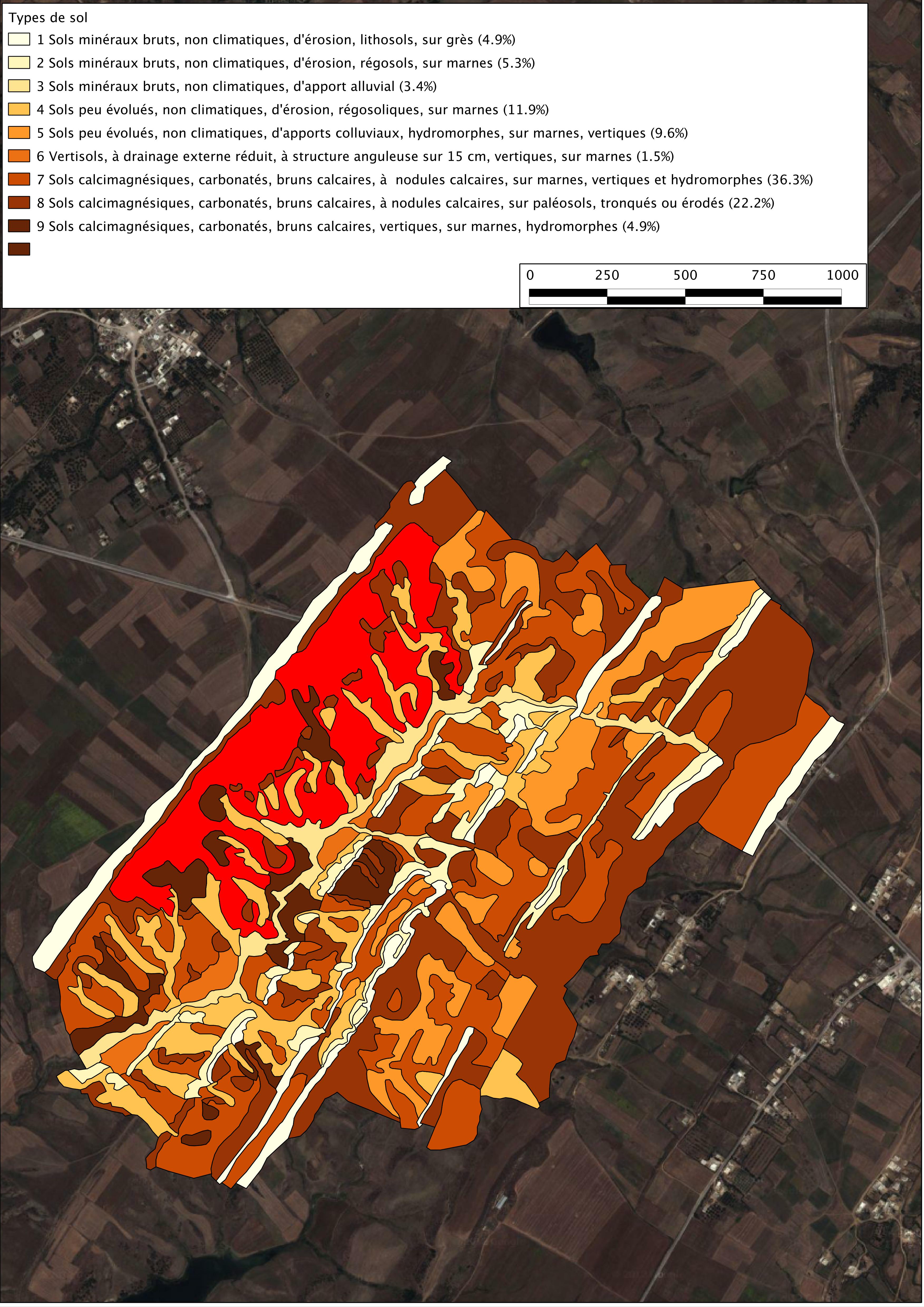
Kamech : Carte pédologique
carte pédologique du bassin versant de kamech dressé par P. Zante en 2003
Simple
- Date ( Création )
- 2003-01-01
- Date ( Révision )
- 2003-01-01
- Identificateur
- carte_pedologique_de_kam_20131204_160503
Gestionnaire
- Fréquence de mise à jour
- Inconnue
- GEMET - INSPIRE themes, version 1.0
-
- Soil
- Mots clés
-
- kamech
- pédologie
- sol
- tunisie
- Limitation d'utilisation
- conditions inconnues
- Contraintes d'accès
- Autres restrictions
- Autres contraintes
- usage interne
- Restrictions de manipulation
- Restreint
- Type de représentation spatiale
- Vecteur
- Distance de résolution
- 2 metres
- Dénominateur de l'échelle
- 5000
- Langue
- fre
- Catégorie ISO
-
- Farming
- Environment
- Imagery base maps earth cover
- Description
- Kamech (Tunisie)
N
S
E
W
))
- Nom du système de référence
- Carthage /Lambert Nord Tunisie (EPSG 22391) /
- Type de géométries des objets
- Polygone
- Format (encodage)
-
-
carte pédologique de Kamech
(
2003-01-01T12:00:00
)
- Spécification
- Shape au format shp.
-
carte pédologique de Kamech
(
2003-01-01T12:00:00
)
- Ressource en ligne
- tn_kamech:pedo_2003_ltn ( OGC:WMS )
- Niveau
- Jeu de données
Résultat de conformité
- Date ( Publication )
- 2010-05-03
- Explication
- Non evalue
- Généralités sur la provenance
- carte pédologique dressé par P. Zante en 2003
- Description
- carte pédologique du bassin versant de kamech dressé par P. Zante en 2003
gmd:MD_Metadata
- Identifiant de la fiche
- Expire_529ee237a9b8e XML
- Langue
- fre
- Jeu de caractères
- Utf8
- Identifiant de la fiche de métadonnées parent
- Kamech : Carte pédologique Expire_529ee237a9b8e
- Type de ressource
- Jeu de données
- Nom du niveau de hiérarchie
- Données géographiques
- Date des métadonnées
- 2022-07-13T15:43:39
- Nom du standard de métadonnées
- ISO 19115:2003/19139
- Version du standard de métadonnées
- 1.0
Point de contact
Aperçus

thumbnail
large_thumbnail
Fourni par

Ressources associées
Not available